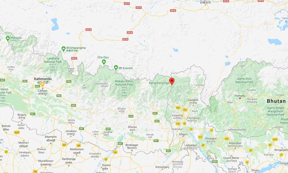
Kanchenjunga Trek Map, which navigates the foothills of the mighty Kanchenjunga (8,586 meters), the third-highest alpine peak in the world, is among the most popular off-beaten Himalayan exploration prospects in Nepal. This classical Himalayan journey promises the most remarkable experience navigating remote and rugged trails of the most isolated region in the country, ideal for the trekking enthusiast who is looking for an authentic Himalayan experience.
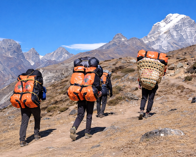
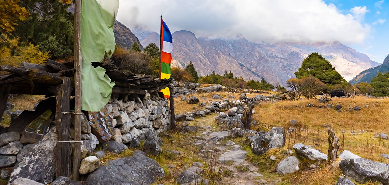
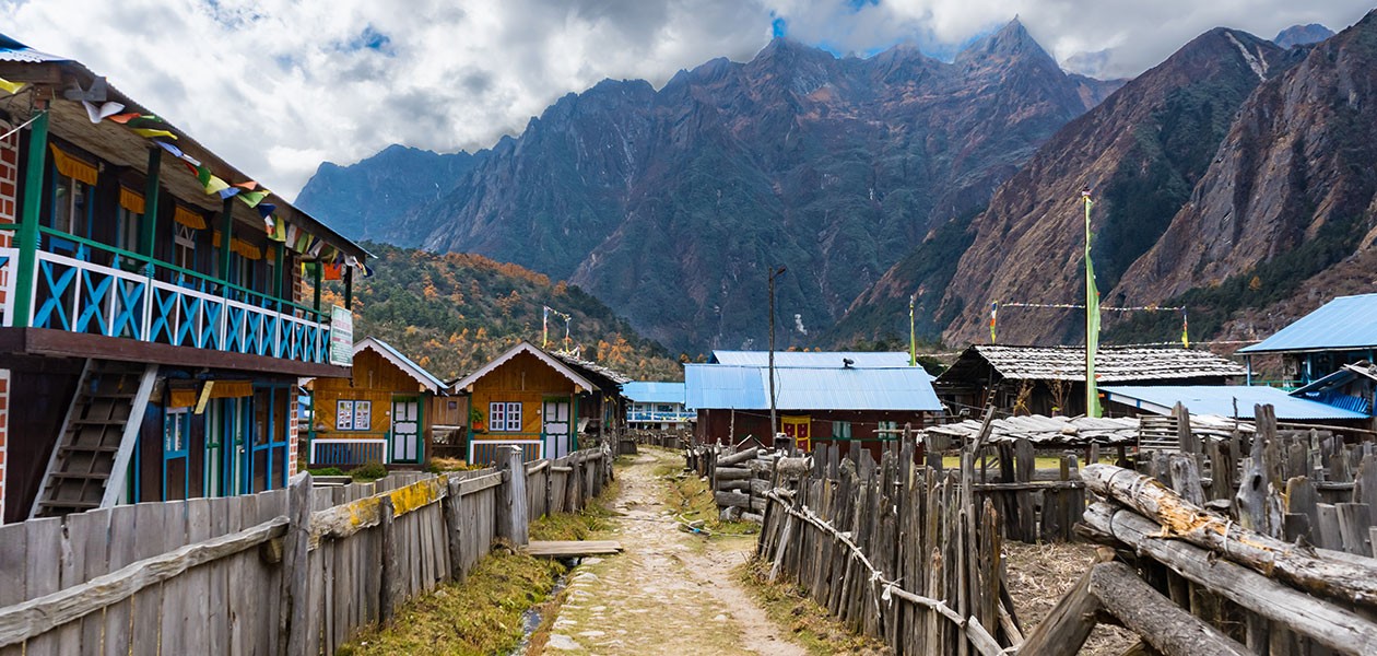
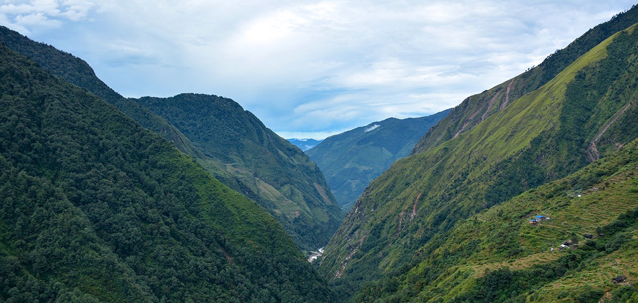
Passing across the high Himalayan settlements that preserved ancient culture, traditions, and artifacts, you will get a chance to relish their warm hospitality. You will also have the opportunity to delve into the incredible bio-diversity of the Kanchenjunga Conservation Area. As you traverse across the enhancing landscapes of the country, from cascading waterfalls/rivers to terraced farms with lush vegetation, glacial moraines, and peaceful meadows that unveil the epic views of the far eastern Himalayas, this journey to explore Himalayan wilderness turns into a magical experience.
If you are curious about the Kanchenjunga Trek Map, the highlights of the journey, elevation points throughout the trip, and overall itinerary plans, we will discuss every aspect of this iconic journey in this article.
Kanchejunga Trek Map- Tinieray Route Outline
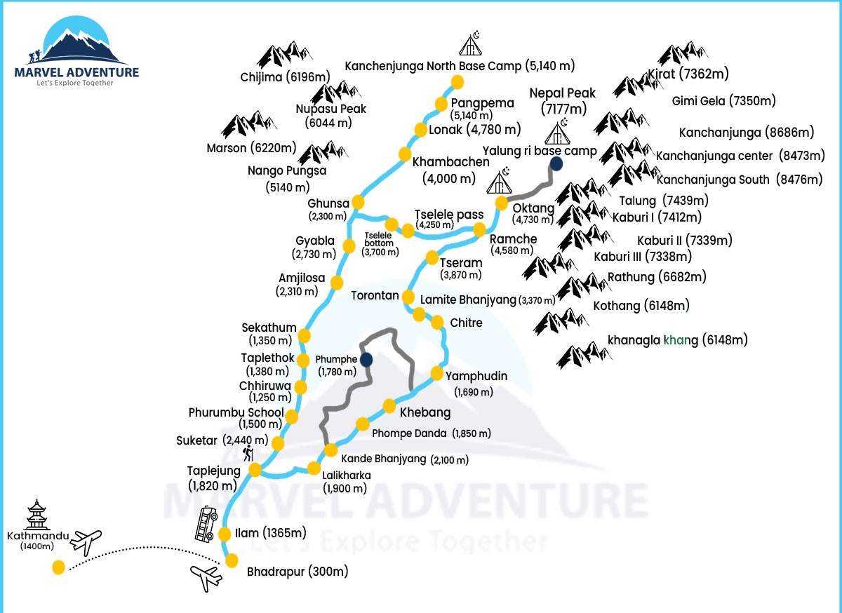
Your general Kanchejunag Trek Map follows the following itinerary plans. Depending on the route, highlights exploration, and overall length of the trip, the overall plans may vary slightly from package to package.
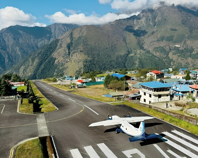
Day 01: Flight from Kathmandu to Bhadrapur and drive to Phidim
Day 02: Driving from Phidim to Taplejung and trek to Sinuwa
Day 03: Trekking from Sinuwa to Tapethok
Day 04: Tapethok to Amjilosa trek
Day 05: Amjilosa to Gyabla
Day 06: Trekking from Gyabla to Ghunsa
Day 07: Rest and acclimatization day at Ghunsa
Day 08: Trekking from Ghunsa to Khambachen
Day 09: Trek from Khambachen to Lhonak
Day 10: Lhonak to Kanchenjunga North Base Camp and return to Lhonak
Day 11: Trekking from Lhonak to Khambachen
Day 12: Khambachen to Phaley trek
Day 13: Phaely to Amjilosa
Day 14: Trekking from Amjilosa to Tapethok
Day 15: Tapethok to Sinuwa trek
Day 16: Trekking down to Taplejung from Sinuwa
Day 17: Drive down to Bhadrapur from Taplejung
Day 18: Fly back to Kathmandu from Bhadrapur
Kanchenjunga Trek Overview
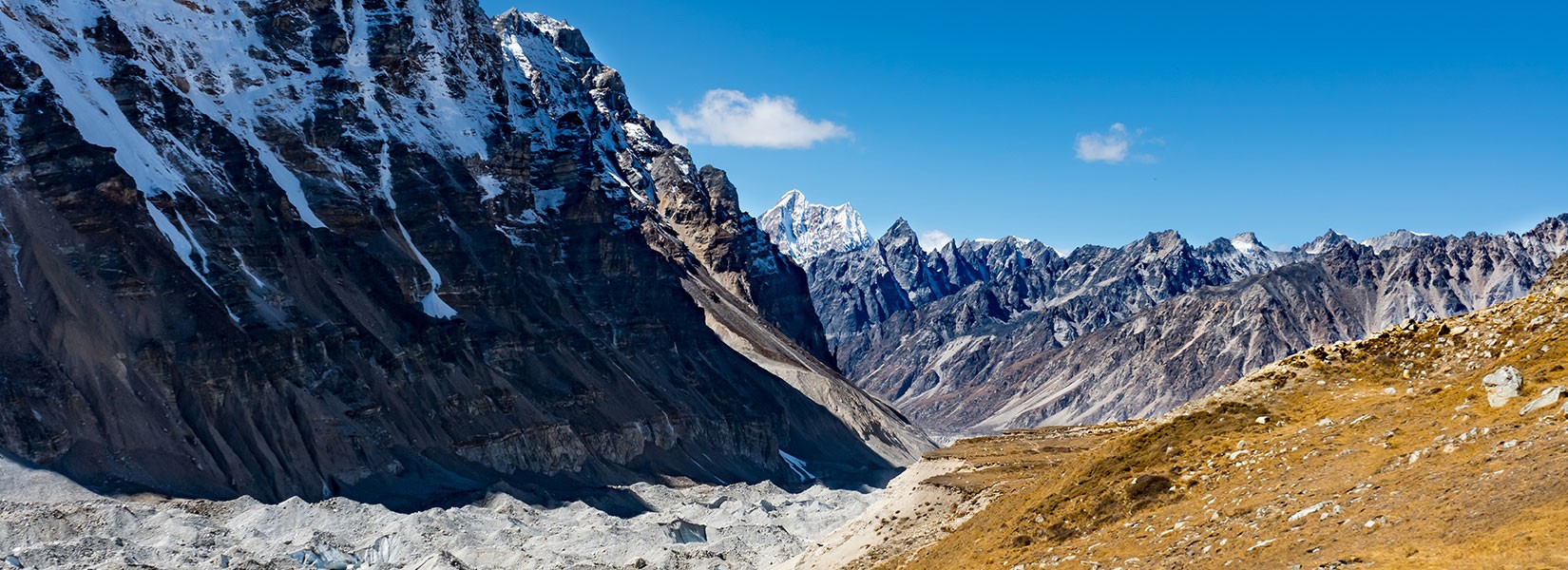
Kanchenjunga Trek, which takes place in the far eastern Himalayas, is one of the most incredible off-beaten trekking experiences in Nepal. This classical Himalayan route that explores the base of the third highest peak in the world takes you across the most isolated trails in the Himalayas that are in their pure, raw state. Besides the incredible wilderness factor that provides you the opportunity to connect with nature, you will also have the opportunity to explore the beautiful Himalayan settlements that still preserve their ancient culture, traditions, and crafts.
Your journey on this most iconic and crowned trail for the off-beaten and wilderness exploration starts with a thrilling flight from Kathmandu to Bhadrapur. After completing the driving part from Bhadrapur toPhidim and Phidim to Taplejung, you will set foot on the iconic trail of this remote adventure heading toward Sinuwa. Moving across the gradually inkling trails, you will trek across the beautiful settlements of Tapethok, Amjilosa, Gyabla, and Ghunsa. Before moving further with the Kanchenjunga Trek map that leads you to even further elevation points, you will take a rest day at Ghunsa to acclimatize properly to the new altitudes.
Then, navigating your way across Khambachen and Lhonak, you will finally reach the Kanchenjunga North Base Camp. The exploration of this mighty northern base camp of the third-highest peak in the world will mark the closure of your incredible Himalayan journey. You will then retrace your steps back to Khambachen and make your descent to Phaley, from where you will re-join the classical route of this adventure at Amjilosa. You will continue your descending journey across Tapethok and Sinuwa to reach Taplejung. Your drive down to Bhadrapur will follow the flight back to Kathmandu, and your remarkable off-beaten Himalayan exploration will be complete.
Kanchenjunga Trek Map- Detailed Route and Daily Activities
Day 01: Flight from Kathmandu to Bhadrapur and drive to Phidim
Kathmandu Altitude: 1,400 meters/ 4,593 feet
Bhadrapur Altitude: 91 meters/ 298 feet
Phidim Altitude: 1,365 meters/ 4,478 feet
Altitude Loss: 35 meters/ 114 feet
Your journey on this exciting far eastern Himalayas starts with a morning flight from Kathmandu to Bhadrapur. This flight will last about 45 minutes, and from Bhadrapur, you will then drive about 4 hours across the lush landscapes to reach Phidim.
Day 02: Driving from Phidim to Taplejung and trek to Sinuwa
Phidim Altitude: 1,365 meters/ 4,478 feet
Taplejung Altitude: 1,820 meters/ 5,971 feet
Sinuwa Altitude: 980 meters/ 3,215 feet
Altitude Gain: 455 meters/ 1,492 feet
During the first part of this day’s adventure, you will drive from Phidim to Taplejung on Mechi Highway. Then, from Taplejung, trekking past the traditional villages with unique mud houses and terraced farms alongside the Tamur River, you will reach Sinuwa.
Day 03: Trekking from Sinuwa to Taplethok
Sinuwa Altitude: 980 meters/ 3,215 feet
Taplethok Altitude: 1,380 meters/ 4,527 feet
Altitude Gain: 400 meters/ 1,312 feet
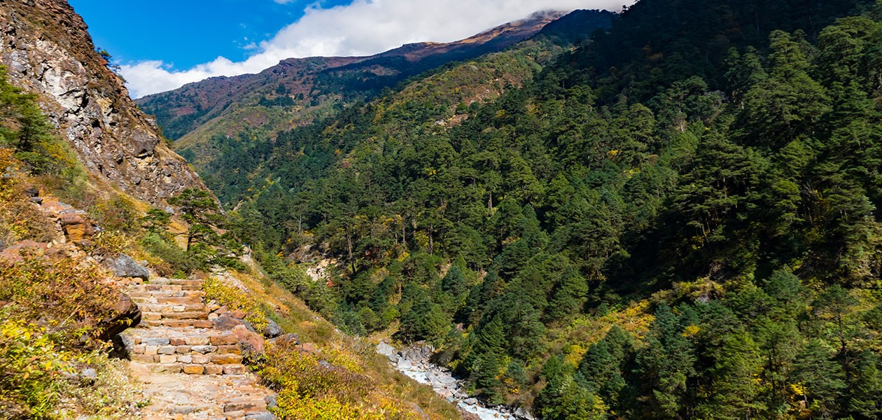
You will continue trekking alongside the Tamor River and traverse across the rich vegetation and forested trails on this day’s trekking trails. You will gradually ascend on the charmings trails to reach Taplethok for an overnight stay.
Day 04: Tapethok to Amjilosa trek
Taplethok Altitude: 1,380 meters/ 4,527 feet
Amjilosa Altitude: 2,310 meters/ 7,578 feet
Altitude Gain: 930 meters/ 3,051 feet
Ascending to a higher elevation, you will cross a suspension bridge over the Tamor River and pass the cardamom field heading toward Sekhathum. Then, trekking past the dense forest across the hamlet of Zaubaru, you will reach Amjlosa.
Day 05: Amjilosa to Gyabla
Amjilosa Altitude: 2,310 meters/ 7,578 feet
Gyabla Altitude: 2,725 meters/ 8,940 feet
Altitude Gain: 415 meters/ 1,361 feet
Moving along the banks of the river, you will enter the lush, forested trails of bamboo, fir, and rhododendrons. You will cross several small bridges along the way and trek past waterfalls to reach Gyabla.
Day 06: Trekking from Gyabla to Ghunsa
Gyabla Altitude: 2,725 meters/ 8,940 feet
Ghunsa Altitude: 3,400 meters/ 11,154 feet
Altitude Gain: 675 meters/ 2,214 feet
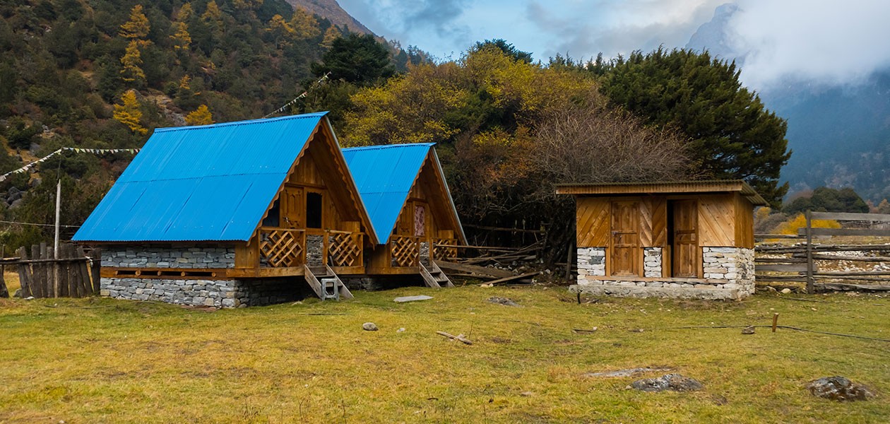
You will trek across the river to the valley and reach Phale, a Tibetan refugee settlement. Then, you will trek past the thick pine and conifer forests to reach the beautiful village of Ghunsa, which has a hydroelectricity plant.
Day 07: Rest and acclimatization day at Ghunsa
Ghunsa Altitude: 3,400 meters/ 11,154 feet
You will take a rest day at Ghunsa today and do short hikes around the region for effective acclimatization.
Day 08: Trekking from Ghunsa to Khambachen
Ghunsa Altitude: 3,400 meters/ 11,154 feet
Khambachen Altitude: 4,100 meters/ 13,451 feet
Altitude Gain: 700 meters/ 2,296 feet
Your trekking route will push for even further altitudes, enjoying the epic views of the Himalayan ranges; you will trek across the river, beautiful pine forest, and serene meadows to reach Rampuk Kharka and eventually climb to Khambachen.
Day 09: Trek from Khambachen to Lhonak
 Khambachen Altitude: 4,100 meters/ 13,451 feet
Lhonak Altitude: 4,780 meters/ 15,682 feet
Altitude Gain: 680 meters/ 2,230 feet
The trekking route on this day is slightly tougher; trekking past landslide-prone areas, you will head toward the pasture land known as Rating. You will then move along the moraines of the Kanchenjunga Glacier to reach Lhonak.
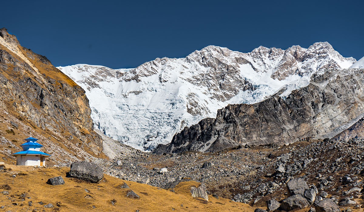
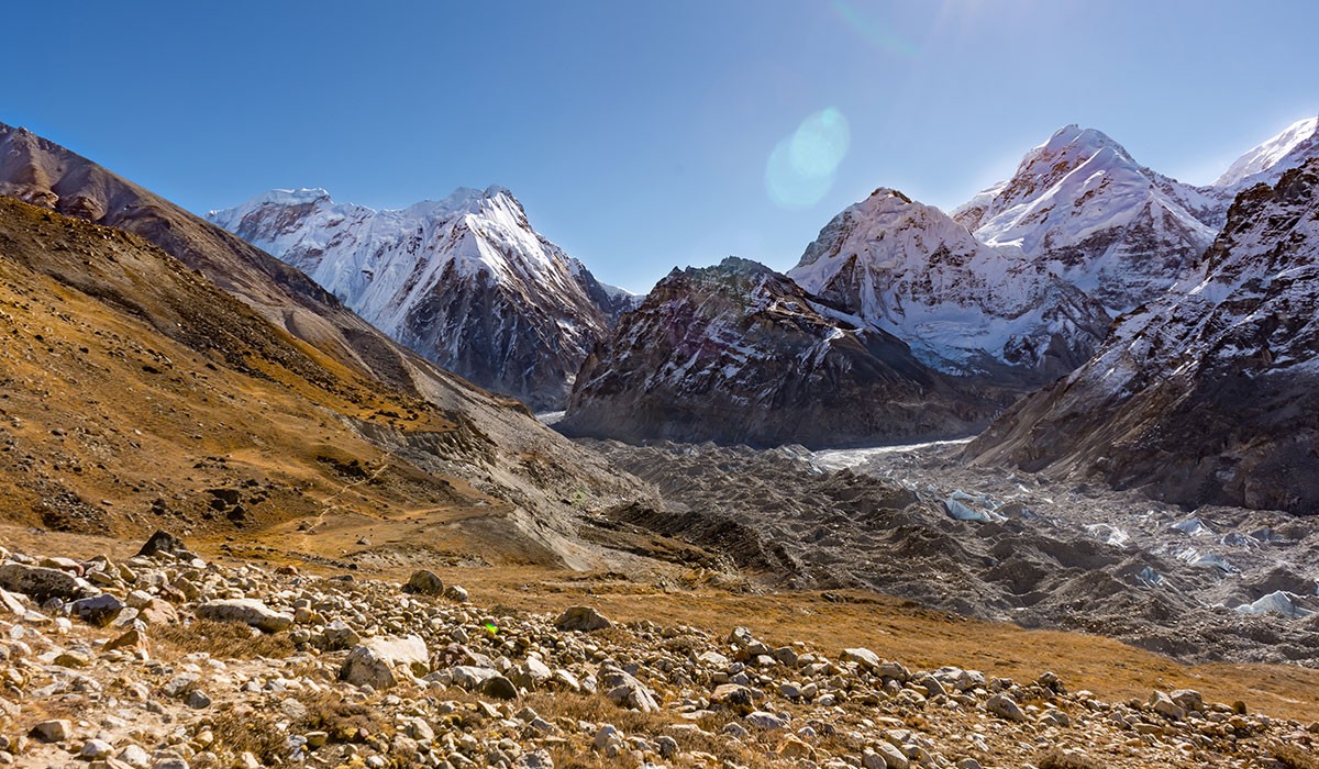
Day 10: Lhonak to Kanchenjunga North Base Camp and return to Lhonak
Lhonak Altitude: 4,780 meters/ 15,682 feet
Kanchenjunga North Base Camp Altitude: 5,140 meters/ 16,863 feet
Altitude Gain: 360 meters/ 1,181 feet
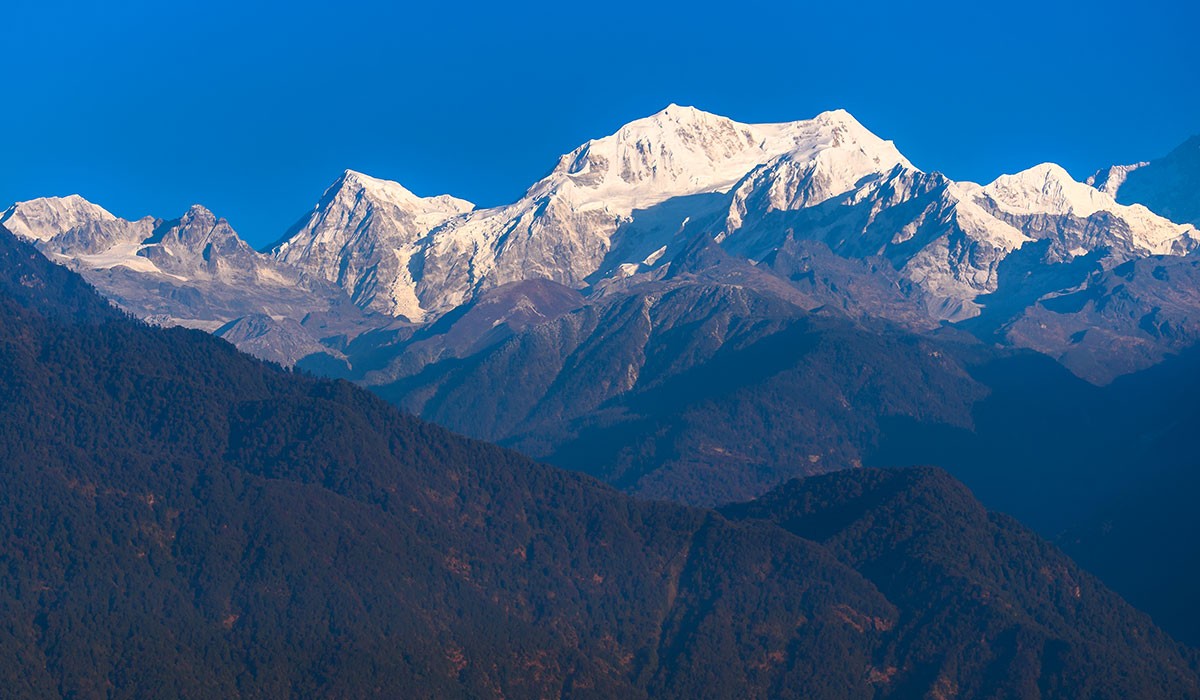
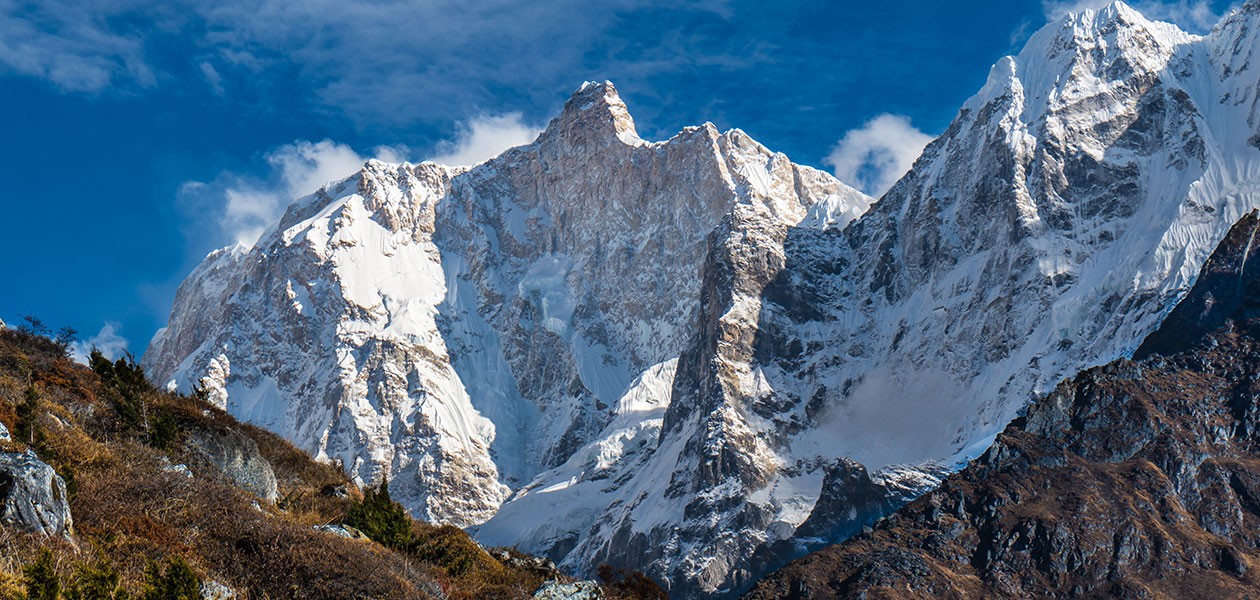
It is the most exciting part of your Kanchenjunga Trek Map; you will continue trekking on the moraines of the Kanchenjunga Glacier and head toward the base camp for incredible views of Kanchenjunga and other surrounding peaks like Tent Peak, Gimmigela Chuli, Nepal Peakk, etc.
Day 11: Trekking from Lhonak to Khambachen
Lhonak Altitude: 4,780 meters/ 15,682 feet
Khambachen Altitude: 4,100 meters/ 13,451 feet
Altitude Loss: 680 meters/ 2,230 feet
You will continue trekking alongside the Kanchenjunga Glacier and trek past the beautiful meadows on the same trekking route to reach Khambachen.
Day 12: Khambachen to Phaley trek
Khambachen Altitude: 4,100 meters/ 13,451 feet
Phaley Altitude: 3,240 meters/ 10,629 feet
Altitude Gain: 860 meters/ 2,821 feet
Its an easy day’s adventure today in this return trek. You will continue trekking downhill across the lush pine forests and cascading waterfalls to reach the beautiful village of Phaley.
Day 13: Phaley to Amjilosa
Phaley Altitude: 3,240 meters/ 10,629 feet
Amjilosa Altitude: 2,310 meters/ 7,578 feet
Altitude Loss: 930 meters/ 3,051 feet
This day’s trekking trail will pass across the charming fir, conifer, and birch forests, and you will also cross several crusading streams. After crossing the Gyabla Village, you will reach Amjilosa.
Day 14: Trekking from Amjilosa to Taplethok
Amjilosa Altitude: 2,310 meters/ 7,578 feet
Taplethok Altitude: 1,380 meters/ 4,527 feet
Altitude Loss: 930 meters/ 3,051 feet
Trekking past the fir, rhododendron, and bamboo forests, this day’s trail will take you alongside the Tamur River . Trekking past Sekhathum, you will then arrive at Taplethok.
Day 15: Tapethok to Sinuwa trek
Taplethok Altitude: 1,380 meters/ 4,527 feet
Sinuwa Altitude: 980 meters/ 3,215 feet
Altitude Loss: 400 meters/ 1,312 feet
You will continue trekking across the lush vegetation alongside the Tamur River and make your descent to Sinuwa.
Day 16: Trekking down to Taplejung from Sinuwa
Sinuwa Altitude: 980 meters/ 3,215 feet
Taplejung Altitude: 1,820 meters/ 5,971 feet
Altitude Gain: 840 meters/ 2,755 feet
This is the final day’s trekking route in your Kanchenjunga Trek Map; traversing across the lush terraced farms and traditional settlements alongside the Tamur River, you will trek down to Taplejung.
Day 17: Drive down to Bhadrapur from Taplejung
Taplejung Altitude: 1,820 meters/ 5,971 feet
Bhadrapur Altitude: 91 meters/ 298 feet
Altitude Loss: 1,729 meters/ 5,672 feet
Driving down from Taplejung, you will join the Mechi Highway and drive across the scenic landscapes to reach Bhadrapur.
Day 18: Fly back to Kathmandu from Bhadrapur
Bhadrapur Altitude: 91 meters/ 298 feet
Kathmandu Altitude: 1,400 meters/ 4,593 feet
Altitude Gain: 1,309 meters/ 4,294 feet
After wrapping up your exploration in the far eastern Himalayas, you will fly back to Kathmandu.
Get Insights On:
How Difficult is Kanchenjunga Trek?
Kanchenjunga Trek is one of the most incredible remote Himalayan journeys that takes you across the isolated parts of the far easter Himalayas. As you have to traverse across several high-altitude points in your journey and even cross some of the demanding Himalayan passes, the journey in this isolate region is considered a challenging endeavor. The overall duration of the trip, which can last 20 to 25 days, and the complete isolation from modernity can be testing aspects of the trip that might be hard for the trekkers who are not used to leaving their comfort zone.
However, when talking about our exciting 18 Days Kanchenjunga Trek package, it is one of the most well-designed trekking endeavors for the off-beaten experience in the Kanchenjunga region. This trekking prospect to experience the unspoiled wilderness of the far eastern Himalayas has just a moderate level of difficulty. You won’t have to take on any challenging and physically demanding Himalayan passes, and the length of the trek isn’t that long considering the overall highlight explorations.
In this classical Himalayan base camp adventure, you will trek an approximate distance of about 200 km (124 miles). The normal walking hours during each of the treks will be about 6 to 7 hours; thus, a good amount of physical preparation is necessary to comfortably do this trek. Similarly, the altitude gain in this trip is another major hurdle; you will start moving along the rugged route of this Himalayan journey from Taplejung (1,820 meters) and will reach the highest point of the trip at Kanchenjunga North Base Camp (5,140 meters).
The overall altitude gain of the trek will be about 3,320 meters (10,892 feet) on the trekking route. Even though there aren’t challenging Himalayan passes that you have to overcome enroute during this adventure, the altitude gain is still significant; you will need to acclimatize properly and pay attention to any signs related to altitude sickness.
Efficient Preparation for Trek
Kanchenjunga Trek is undoubtedly one of the most beloved off-beaten remote Himalayan explorations. This classical Himalayan adventure is suitable for trekking enthusiasts who are looking for an opportunity to reconnect with nature and reboot their system, staying farther from the modern life hustle-bustle. Following the Kanchenjunga Trek map that takes you across the untamed wilderness, rugged landscapes, and isolated settlements of the Himalayas is in no way an easy odyssey.
However, if you prepare yourself enough, this remote exploration can turn out to be a life-changing journey. First of all, this long Himalayan excursion, which is over two weeks, is a physically demanding endeavor; you will have to trek for long hours on gradually inclining rugged routes. So, your first priority should be developing your overall strength and stamina aspects. Although you are recommended to train for about 3 to 8 weeks for the Himalayan treks, you can adjust the period depending on the free hours you have in your schedule and your fitness level.
You should make an adequate amount of preparation to pull off at least 6 to 7 hours of slow-paced walking carrying your backpack (upto 15 kg of your luggage is carried by your porter). To properly understand this scenario, you can also do some practice hikes to nearby steep sections, which will also help you to understand the aspects you need to work on. For strength exercises, you can include several exercises like Push Up, Pull Up, Plank, Weiglight, Bicep Curl, Le Press, Leg Extension, etc.
Similarly, stamina exercises like Jogging, Cycling, Swimming, Jumping Rope, Dancing, Aerobics, etc are known to improve your cardiovascular health as well. If you efficiently include these exercises in your training routine, they will be very helpful during the acclimatization process. Focussing on both of these training aspects will ensure a comfortable experience and you will be able to create memories on these isolated trails of the Himalayas more confidently.
When Should I Do Kanchenjunga Trek?
Moving along the exhilarating trails of the Kanchenjunga Trek Map is an unforgettable journey regardless of the season you choose to partake in it. However, as the off-seasons can be slightly more challenging on this already physically demanding journey, we will recommend the peak seasons of the year, like autumn (September, October, and November) and spring (March, April, and May) for novice trekkers. Taking on this off-beaten route of the isolated far eastern Himalayas rewards you with different experiences with every passing season.
The spring season, which is the most preferred season for an uncomfortable experience, allures travelers with its unparalleled natural beauty. Compared to the extreme heat of the monsoon, the spring season has favorable and warmer climatic conditions, that’s why this season sees a surge in the number of trekkers, unlike any other season. The pleasant temperatures, even at the alpine altitudes, the lush landscapes adorned with a diverse range of visually appealing flowers, the crusading rivers/waterfalls as the snow starts to melt, and the sparkling views of the pristine peaks under clear skies make the trekking this trekking adventure in spring an unforgettable experience.
Similarly, autumn, another high season, is mostly popular for its dry climatic conditions. Dry and coll weather means, you don’t have to worry about bugs and leeches, and you will neither field too cold nor too hot during your outdoor journey. The days of the autumn season are not covered with fog and clouds due to the low precipitation rate; thus, the visibility of the Himalayan vistas stretches to the end of the horizon. Besides the incredible natural allurements, the cultural prospects are another aspect to look forward to. You will be able to relish some of the most vibrant festivals of the country in the autumn season, like Dashain, Tihar, Chhath, Mani Rimdu, Indra Jatra, Sita Bibaha, etc.